Charlie’s Bunion, which can be reached from the Newfoundland Gap parking area on Hwy 441, was created in the 1920s when a fire razed the area. The exposed humus was washed away shortly after in a rainstorm. The highest elevation on the trail is 6122 feet.
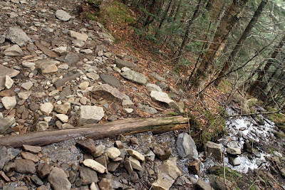
It’s an 8 mile round trip to visit Charlie’s Bunion, and the trail is well defined and in good shape. You’ll walk over and maneuver around many rocks and go through elevation changes, as you would expect in the Smoky’s. The photos give you an idea of the terrain.

My hike, and the photos in this blog, took place on 3/29/2012.
I started at 10:30, which is much later than I had scheduled to start. I planned to photography the sunrise off the Clingman’s Dome road and then start the hike, but when I woke up that morning in Sevierville I saw daylight coming in through the window blinds and knew I had missed the alarm. Guess I needed the rest. Before heading out I made sure I had plenty of water and snacks, and rain gear. The weather forecast for Sevierville was sunshine and no chance of rain, so I figured it would be a good day for the hike. As it turned out, the rain gear was a good decision.

The 4.1 mile trek covers a portion of the Appalachian Trail. I started at the parking area and headed up the trail, which is mostly uphill for the first couple of miles. Lots of rocks and a good warmup. A hiker caught up with my while I was snapping photos, and in our conversation he said his son had passed by earlier, and planned to walk 11 miles that day. He is walking the entire AT, and his dad is following in his RV and meeting up with him through the journey. What a great way for dad and son to spend six months together sharing a dream.

 At the 1.7 mile point I reached the intersection of the Sweet Heifer Trail, which forks off to the right. You must continue on straight here.
 A short walk down the Sweet Heifer Trail, and the view is beautiful. I can tell the first part of this trail will be gorgeous when everything blooms.
Back to the AT, Go straight at the Sweet Heifer Trail junction, and a mile further you reach the junction of Boulevard Trail.

At this point you turn right. Charlies Bunion is 1.3 miles ahead.
After the Boulevard junction look for great views to your right, then at approximately 0.2 miles you reach the Icewater Springs Shelter. Three hikers were sitting on the bench at the front rail, and two more hikers who are hiking the entire AT stopped in. The sleeping area has a canvas hung to protect the campers from the elements, but it won’t stop bears from getting inside and foraging for goodies. I spoke to a GSM employee who was working on the trail just past the shelter, and he said the shelter is closed for three months during the summer due to bear activity. Seems the bears have learned where to find easy food. He said the campgrounds in lower elevations have frequent visits from bears because of food being left out. Once they lose the fear of people, they are a danger to themselves and potentially to humans.
 |
| Looking out from the shelter |
 |
| Looks like a face burned into the wood |
 |
| Crossroads |
 |
| Serenading |

Posters were left out throughout the trail for a missing hiker, who has been unaccounted for almost two weeks. This probably accounts for the four ranger vehicles in the parking lot.
Spring water is available just past the shelter, but it must be treated.
Past the shelter the trail begins a long downhill run, which can be tiring coming back up. Through this section a few streams run down from the left, across the trail, and further down. The Park Service has done a great job maintaining the trail.
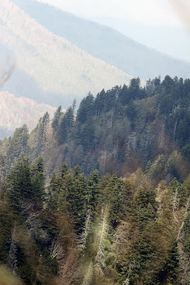
Approaching Charlie’s Bunion, the views turn spectacular to your left. Sheer drops and contrasting hues across the mountains make this well worth the hike. When you reach Charlie’s Bunion, the sign says “Closely control children.” That’s an understatement, as the photos show.
 |
| Across the path and on down the moountain |
 |
| Nice overlook |
 |
| Started sprinkling rain here |
As I approached the final stop, I found old hidden fears can surface when you don’t see it coming. Most of my hiking has been at lower elevations, and I admit I got a bit wobbly-kneed on the last piece of the trail. I need to push through this. A few raindrops at the Bunion, the first hint of a storm system coming, didn’t help either. Still, what an amazing view, it was worth pushing through a few nervous moments.
Returning was uneventful for the first three miles, once I got past the uphill portion leading to the shelter.
 |
| A steady rain |
Then light rain began sporadically filtering through the trees and touching my head, arm, or my cameras. Before long it became apparent the rain wasn’t going away, and I stopped and pulled my rain parka out of my backpack, and replacing it with one of my cameras and lenses. The other camera hung around my neck and was tucked safely under my parka.
I kept a steady but slow pace, in consideration of my tired legs and a wet, slippery trail that has many boulders to climb over on this portion of the trail. Fifteen minutes from the parking lot the thunder picked up and a loud, crackling lightning strike hit nearby. A couple of rangers, both much younger and in much better shape than me came up from behind and, as they went by, one said they had been tracking this storm, and it was dangerous. I eventually made it to my car, just like they both did.
 |
| Newfoundland Gap parking area |
To summarize, this is great trail with incredible views. I plan to return after the seasons have done their thing and allowed the greenery to fill back in.
Go prepared.


