The Greenbrier section of the Great Smokey Mountains is peaceful and relaxing, with some of the best views of the rivers in the park. Drive through to the Ramsey Cascades trail head and you'll cross over several bridges, with plenty of ops to pull over and enjoy the relaxing sounds of the water cascading over rocks.
I arrived at 9:30 am to hike the Porters Creek Trail. The first mile is on the old road that takes you through old settlements. You'll see a number or rock walls to your right, and if you venture off the trail you can see the remnants up close. Rock steps lead up to a small cemetery that's still kept up by family members, and nearby you'll find a few remnants of a Model T Ford.
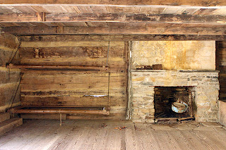
At the one mile lark the trail splits. At this point take a 200 yard detour and view the old John Messer Barn, and further back you'll find the house built by the Smoky Mountain Hiking Club in the 1930's. It was used until the early 80's. Afterwards, continue on Porter's Creek Trail.
At the 1.6 mile mark you'll cross a footbridge that was a bit scary on the day I hiked across. The water was flowing good from all the snow melting on LeConte. After you reach the other side, and a very short hike from there, you'll notice the landscape changes, at least in mid March. The grasses and banks are more of a rich green, like carpet, and locals tell me I was 2 or 3 weeks early. Wildflowers cover this area, and the banks look like they're covered with a layer of snow. This is a popular area in early April.
At 2.0 miles you'll see a waterfall on the left. This is a good place to go back if you wish, or you can continue on to campsite 31, which ends at the 3.7 mile mark. When I arrived there three guys were hanging out. They had camped the night before. One pointed ahead to the steep mountain, which is Charlie's Bunion, and said a couple of guys asked them if they wanted to scale it, and they declined. This is actually a non-maintained trail that you can read about online; sounds pretty tough.
A nice day hike, not too steep. You won't see the ridges and vistas on this one, but it's a beautiful hike with a nice, relaxing flow of water to accompany your entire trek. 7.4 miles total, if you go all the way to campsite 31.


